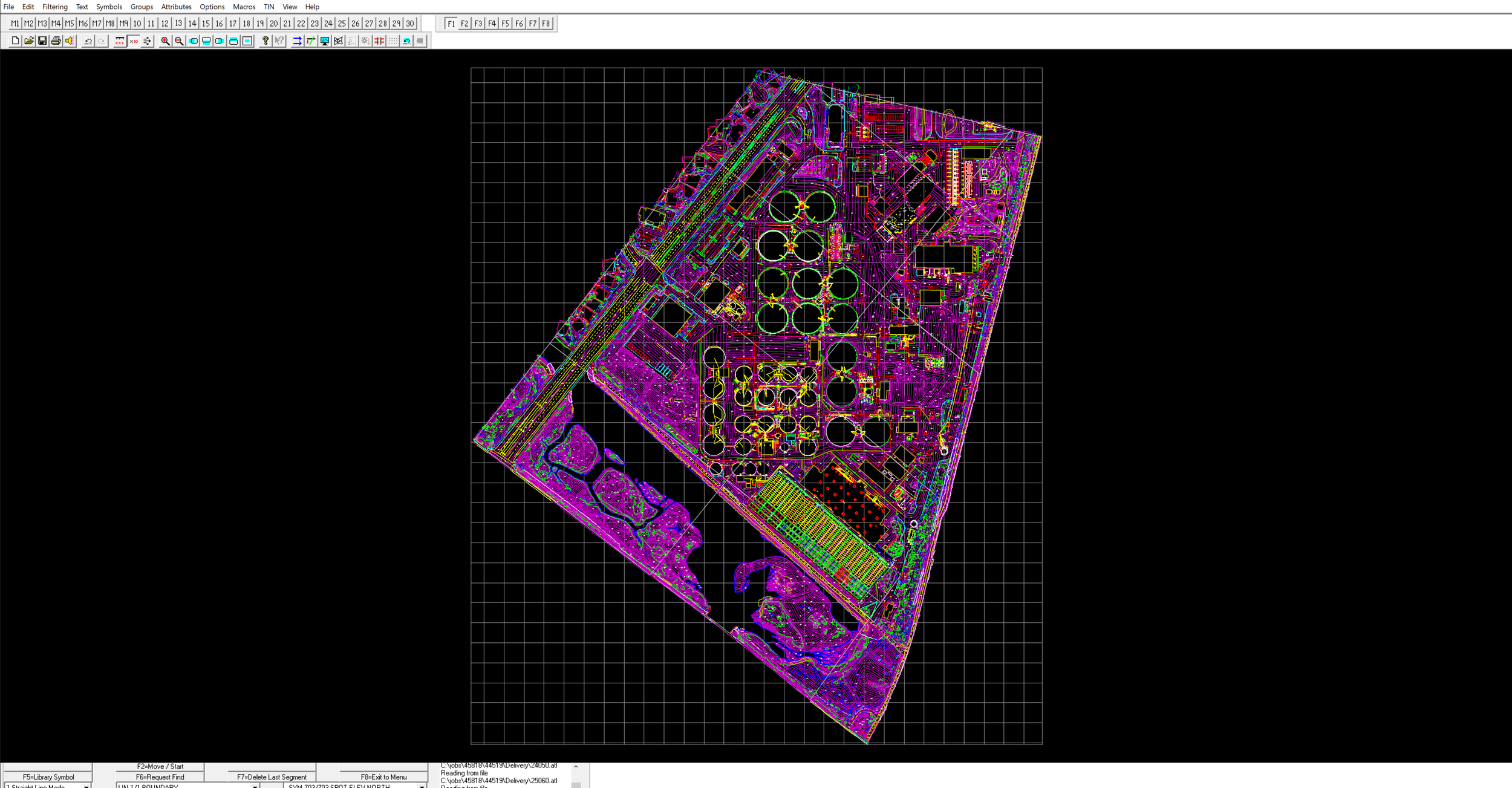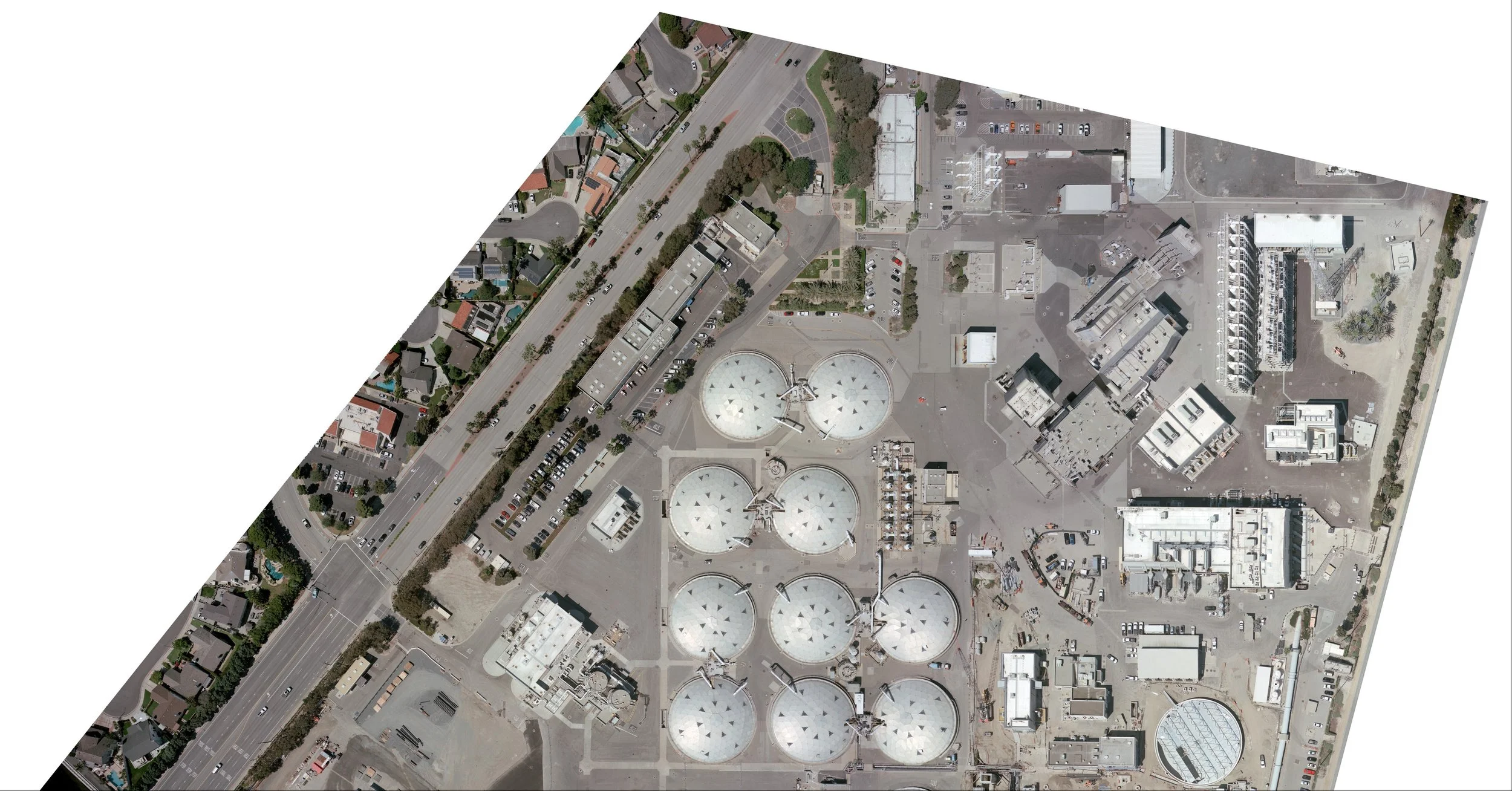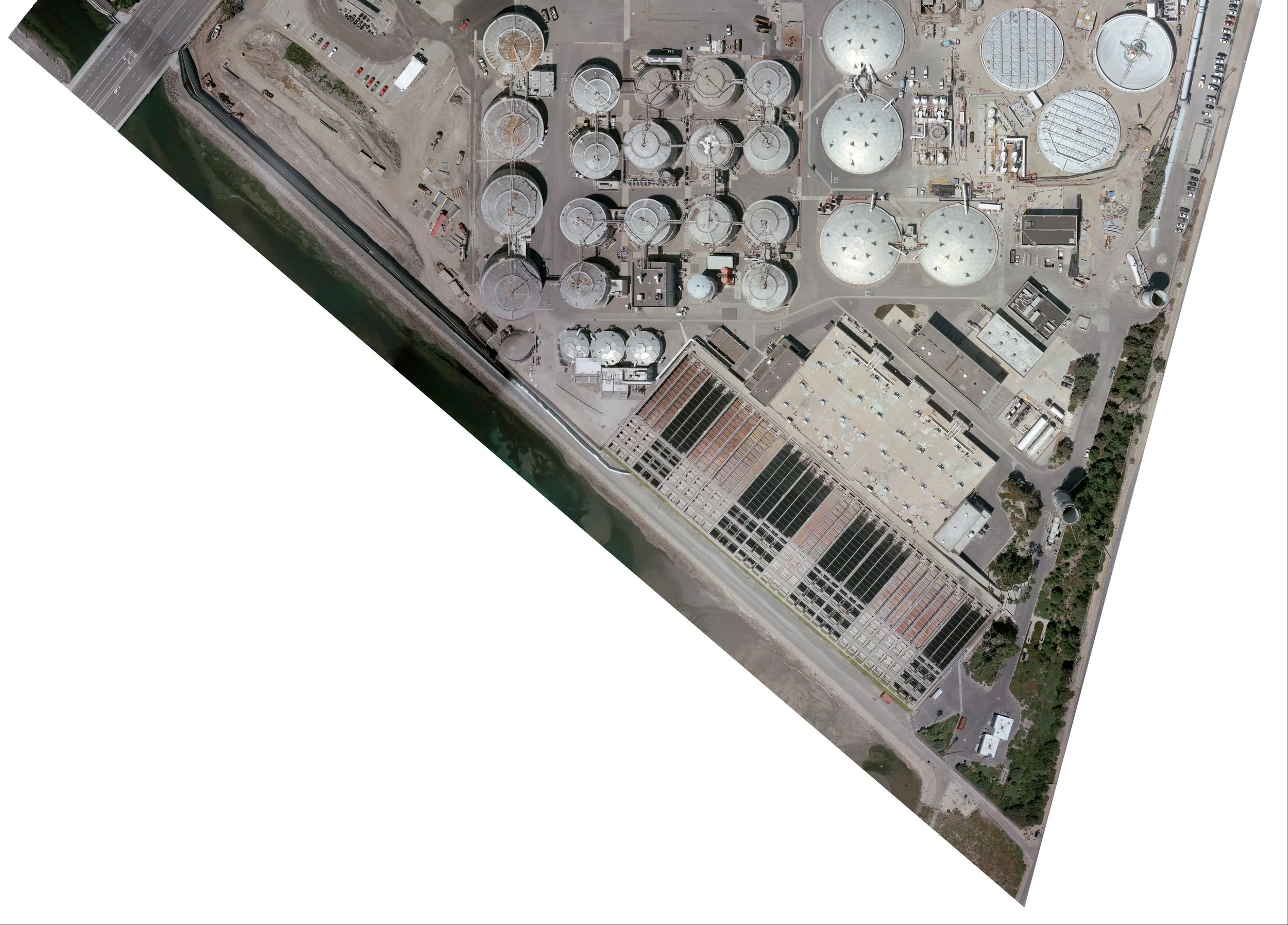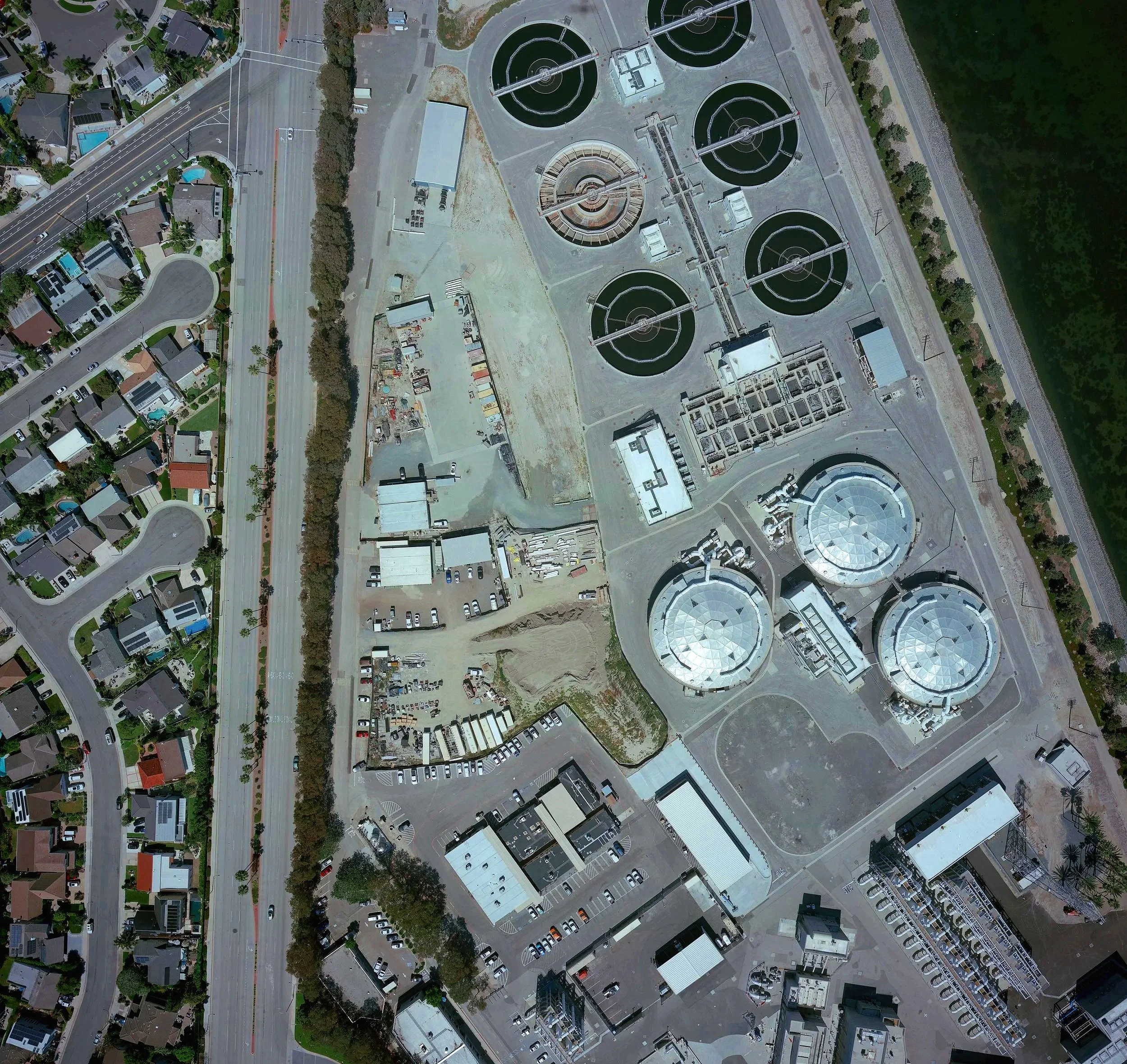
OCSD Plant 2, Huntington Beach
This is one of our most recent aerial surveys of the Huntington Beach OCSD Plant 2, one of the largest wastewater treatment facilities on the West Coast. Our team delivered detailed topographic mapping and high resolution orthomosaics that gave engineers, planners, and facility managers a clear, accurate picture of the site from above. Collected at 20’ scale and ½ foot contours.